Saturday, December 31, 2011

Doughnut Falls Snowshoe

Beautiful blue sky, clean air, and lots of fun.  Because of the low snowfall this year, a lot of folks on the trail were hiking without snowshoes.   But poles are highly recommended. 
God blessed us with a refreshing day in the mountains!


DESCRIPTION:  Follow the Cardiff Road up to the Summer trailhead, where you'll see a restroom.   Get off the road, and follow the snowshoe trail up the hill.   The trail will cross a bridge and join the Cardiff Road.   When you come to a fork in the trail, stay to the left fork.   Follow the trail down to the narrows, where you'll have to climb down a few icy boulders.   Go up the stream bed and see the falls.  
RATINGS: MODERATE
BIG COTTONWOOD WATERSHED: No dogs allowed
MILEAGE: 3.15 miles round trip from Big Cottonwood Rd.
HIKE TIME: 3 hours
ELEVATION GAIN: 490'
PARKING: 8.8 miles up Big Cottonwood, park at Mill D South Fork,
"Cardiff Fork Road and 9730 E. Big Cottonwood Rd, SLC, UT"
RESTROOM available at the parking area.
GEAR: Poles, snowshoes, sunscreen, sunglasses, knit hat, insulate gloves, snow boots, water, energy snacks, and camera.
DIRECTIONS: Big Cottonwood Canyon begins at Fort Union Blvd and Wasatch Blvd in Salt Lake City, UT

Saturday, December 17, 2011

SNOWSHOE 101

BIG COTTONWOOD CANYON
God blessed us with a sunny day in the mountains!  Pure blue sky!  It was great to escape Smog Lake City, getting out of the cold valley, and to breathe clean fresh air...what a blessing!  


MILL D SOUTH FORK
Cardiff Fork Road, 9730 East and Big Cottonwood Road
RATINGS: NEWBIES - easy terrain for beginners and kids
GEAR: Snowshoes, poles, hat, insulated gloves, snow pants, sunscreen, sunglasses, water, camera, day pack, energy snacks, wear layers of clothing.
HIKE TIME: 2 hours
MILEAGE: 1 1/2 miles
DIRECTIONS: From I-215 take the ski exit,  drive up 6200 South and continue on Wasatch Blvd.  Turn left to Big Cottonwood Canyon Road at Wasatch Blvd and Fort Union Blvd.   Drive up to Mill D South Fork and park.

Saturday, October 22, 2011

Autumn Tour Provo Parkway

God gave us a great and wonderful day!

PROVO CANYON
Enjoy an Autumn bicycle ride on the Provo Parkway.   Finding your way through the I-15 construction and detours, is like driving through a Utah Valley Corn Maze.   The Provo River Parkway is closed under I-15.


VIVIAN PARK


PAUL REAM WILDERNESS PARK to VIVIAN PARK LOOP
RATINGS: Moderate ride on pavement
MILEAGE: 24 miles total
ELEVATION GAIN: 650'
BICYCLES: All bicycles
RIDE TIME: 3 1/4 hours
RESTROOMS available at parks along the trail.
GEAR: Helmet, pump, extra tube, flat repair tools, water, sunscreen, jacket, and energy snacks.
TRAILHEAD: Paul Ream Wilderness Park, Independence Ave and 500 North, Provo, Utah

Tuesday, October 18, 2011

Grandview to Horseshoe Mesa

  
GRANDVIEW TRAIL
Enjoy an exciting adventure at the South Rim of the Grand Canyon.  From the Grandview Overlook, the trail has steep switchbacks.   This section has shade in the morning and afternoon.   Hiking on the mesa is easy, but the temperature is hotter.


RATINGS: INTERMEDIATE
MILEAGE: 3.1 miles down to Horseshoe Mesa, Pete Berry cabin.
ELEVATION GAIN: 2,560' hiking back to the rim.
RESTROOMS: Backpacker's campsites and group site.
NO WATER on the trail.   You might hide some extra water, half way down the trail.
700' down the east side of Horseshoe Mesa is Page Spring.   A steep climb.
GEAR: Two hiking poles recommended!  High energy food, salty snacks, sports drinks instead of water, sunscreen, hat, map, good hiking shoes, light jacket, and camera.
SIGHTSEEING on Horseshoe Mesa, Pete Berry's Cabin, backpacker's campground, Eastern overlook, and Cave of the Domes.   Add 3 miles to your hike exploring Horseshoe Mesa.
 
HORSESHOE MESA


CAVE OF THE DOMES

EASTERN OVERLOOK


HISTORIC TIN CANS

CAMPGROUND RESTROOM


Saturday, October 1, 2011

Twin Lakes Autumn Adventure

 Wonderful, wonderful, wonderful Autumn day!   The colors were crazy in the mountains!   We read Psalm 47 at Twin Lakes Reservoir.   It was a great day for friends to be in the mountains. Cool mountain air, and warm sunshine!   Autumn leaves were yellow, gold, orange, speckled, brown, and green.


RATINGS: Newbies
MILEAGE: 1 mile to Twin Lakes Reservoir
ELEVATION GAIN 800'
HIKE TIME: Allow 3 hours to enjoy this hike
KID FRIENDLY
WATERSHED: No dogs allowed in Big Cottonwood Canyon; no swimming, and no wading.
TRAIL BEGINS at Silver Lake in Brighton, Utah
DIRECTIONS: Big Cottonwood Canyon begins at Wasatch Blvd; Fort Union Blvd, Salt Lake City, Utah.   Drive up to Brighton and park in Silver Lake parking lot.

Saturday, September 24, 2011

Round Valley Adventure

The adventure began during a cool Autumn day in September.   We met at the Rail Trail parking lot on Prospector Avenue, in Park City, Utah.   After we prayed, we glided down the paved Rail Trail for 2 miles.   At a road, we turned left and went up a paved trail to the Round Valley area.
Our dirt adventure began at the Quinn's trailhead.   We rode up the dirt road and went to a paved parking lot.   From there we climbed the hill up to the Cammy's trail and took a break.   Then we road up to the Valderoad, turned left and went down the Seventy Seven trail.   We road down to the center of the valley and climbed up the ridge.   Turning left, we went up Rad Ridge to the Cammy's trail.   We rode to the Valderoad, turning right and coasting back to the Round Valley ball park.  Then back up the Rail Trail.
RATINGS: Moderate technical
MILEAGE: 13 miles
TIME: 3 hours
RESTROOM available at the Ball Park during the warm seasons.
GEAR: Helmet, water, pump, flat repair kit, first aid, and energy snacks.

Monday, September 19, 2011

Upper Red Pine Lake


Upper Red Pine


Boulder Field

God blessed us with a challenging hike today.   Light snow covered the ground above Lower Red Pine.  It was cloudy, sunny, light rain, light sleet, icy wind, sometimes warm and full of adventure. 
A great day to praise God, fellowship together and even pray.


DESCRIPTION:  Drive up Little Cottonwood Canyon to the White Pine trailhead.  While the trail to White Pine Lake is a winding jeep road;  Red Pine is a steeper singletrack hiking trail.   Once you have arrived at Lower Red Pine, there is no official trail to Upper Red.   Most people climb boulders up the hill.   Fishermen catch monster trout in this lake, when the conditions are right.
RESTROOM at the trailhead.
WATERSHED: No dogs in Little Cottonwood Canyon.  No swimming in lakes.
WILDERNESS AREA:  Red Pine and Maybird Gulch.  No mountain biking.
RATINGS: INTERMEDIATE to Lower Red Pine Lake,
Upper Red Pine is more challenging, climbing over huge boulders.
MILEAGE: 3 miles to Lower Red Pine,  3.6 miles to Upper Red.
HIKE TIME:  Allow 7 hours total,

Wednesday, September 7, 2011

Bristlecone Pine Loop and Yovimpa trail

God gave us awesome views!Begin your hike at Rainbow Point, near the rain shelter.   Following the Rim trail, you will find the beginning of the Bristlecone Pine Loop.  Go clockwise.   On the way you'll find a sign to the Riggs Spring, Under-the-rim trail.  Continuing on the Bristlecone Pine Loop, you will go through a forest of Ponderosa trees and come to another shelter.  This is a great overlook.  At the mid-point, are some Bristlecone Pine trees.  At the end of the loop, take the trail to Yovimpa Point, a handicapped assessible sidewalk trail.  Also, you'll find the other side of the Riggs Spring Loop.
MILEAGE: 1 1/2 miles
HIKE TIME: Allow 1 hour
RATINGS: Newbies
RESTROOMS: Available at Rainbow Point.
PICNIC AREA near Yovimpa trail.

Tuesday, September 6, 2011

Bryce Canyon Overlooks

Natural Bridge
    VISITOR CENTER: This is a good place to begin your tour. Restrooms, souvenirs, movies, and museum.Enjoy God's scenic wonders! This is a great way to see the park! After the Visitor Center, drive to Rainbow Point and take the hike to the overlooks.  Then drive down the road and stop at the overlooks.  Make sure you don't drive too fast to stop.   At Fairview Point, we saw a raven.   God blessed us with a wonderful day!  


  • RAINBOW POINT: Take a drive to Rainbow Point and have a picnic lunch.
  • BRISTLE CONE LOOP and YOVIMPA OVERLOOK.  (Hiking)
  • BLACK BIRCH CANYON
  • PONDEROSA CANYON
  • AQUA CANYON
  • NATURAL BRIDGE
  • FARVIEW POINT (Hiking)
  • SWAMP CANYON
  • PARIA VIEW (Hiking)
  • BRYCE POINT (Hiking)
  • INSPIRATION POINT (Hiking)
RATINGS: NEWBIES
TIME: Allow 5 hours
KID FRIENDLY

Queen's Garden, Peekaboo Loop and Wall Street


Queen's Garden Trail
 
Peek-a-boo Loop


Begin your hike at Sunrise and hike down Queen's Garden.  Don't take the horse trail at the junction.  At the bottom, take the side trail to the Queen's garden.  This is a great place to take a break.
Then hike toward the Navajo Loop.  From there take the Peek-a-boo trail.  Clockwise is the easiest way to go around.
Then go up Wall Street to Sunset Point.  At the top you can either shuttle back to Sunrise Point or walk the rim trail.
Wall Street

RATINGS: MODERATE
KIDS: Older children can make this hike.
MILEAGE: 6 1/2 miles loop
Queen's Garden to Navajo Loop Jct. 1.6 miles,
Navajo Loop Jct. to Peek-a-boo ~ .3 miles,
Peek-a-boo Loop ~ 3 miles
Peek-a-boo to Navajo Loop Jct. ~ .3 miles,
Wall Street to Sunset Point ~ .7 miles,
Sunset to Sunrise Point ~ .5 miles.
HIKE TIME: Allow 4 or 5 hours
RESTROOMS: General Store, Sunset Point, and Peek-a-boo stables.
GEAR: Hat, sunscreen, salty food, sack lunch, camera, and hiking pole, plenty of water.
NO DOGS allowed into the inner canyon; only on the upper rim trails.

Red Canyon Parkway

God blessed us with a wonderful ride in Southern, Utah.  This is a scenic ride, passing the Red Canyon visitor center, tunnels and campground.  It is a fast ride down.   The best time to ride is in the cool morning or evening.
RATINGS: NEWBIES
KID FRIENDLY
MILEAGE: 5.5 miles to road near top.   The trail has been extended several more miles along Highway 12.
BIKE TIME: 1 hour up, 20 minutes down.
DIRECTIONS: Look for "RED CANYON" sign and turn right.  
RESTROOMS: At Thunder Mountain trailhead, and top.

Pinecones, Hoodoos, and Red Rock Canyons


This has been a great weekend to experience God! And to see the beauty of His creation!

FRIDAY: We enjoyed the RED CANYON PARKWAY, bicycle ride.  Then went to Pine Lake Campground and set up our tents.   Then we had a BBQ.   What a feast.  We had a Meet-n-greet, around the campfire.
SATURDAY: Some went road biking from Ruby's Inn all the way to Rainbow Point and back.  Others joined us on the Queens Garden tour and went back to Pine Lake to go fishing.  For the die-hard hikers, we added the Peek-a-boo Loop.  After taking showers and relaxing, we headed back to camp for our famous evening barbecue.  Our group divided: Some went to Bryce to see the stars over the overlook; while others heard a missionary story, James Chalmers, around the campfire.
SUNDAY: After another big breakfast, we had a Sunday morning devotional.  We studied the Feeding of the 5,000; and shared our favorite Bible passages.  Our group broke up into two groups:  One drove to Lower Calf Creek Falls, while the other went back to Bryce to Tour de Overlooks.  We had our last BBQ and campfire.
MONDAY: We had a breakfast, and packed up to go home.  What a weekend!   God gave us great weather--three days of sunshine, no bugs, and wonderful fellowship!

Sunday, August 28, 2011

Lake Blanche Adventure

God blessed us with a wonderful day escaping the scorching 100 degree heat of Salt Lake Valley.  We ate thimble berries on the trail, saw the wildflowers in full bloom, and enjoyed a wonderful falls by Lake Florence.
It was 68 degrees at the lake.
DESCRIPTION:  Parking at the S Curve up Big Cottonwood Canyon is crowded--please carpool when you can.   Go up the paved road by the stream to the trailhead. Near the stone wall at Lake Blanche, you'll find a trail leading down to Florence and Lake Lillian.  


MILEAGE: 7.5 miles total to visit all three lakes.
HIKE TIME: 2 hours 20 minutes to Lake Blanche,  1 hour 20 minutes down.
RATINGS: INTERMEDIATE
NO DOGS: Big Cottonwood Canyon is a watershed area.
NO SWIMMING too!
WILDERNESS AREA:  Please camp 200' away from lakes and stream.
Group size is limited to 10 persons.   No campfires!
RESTROOM:  Flush restroom during Summer season.
DIRECTIONS:  Big Cottonwood Canyon begins at Fort Union Blvd and Wasatch Blvd, Salt Lake City, Utah

Monday, August 8, 2011

Cuberant Lake trail

God blessed us with great fellowship and beautiful scenery.   It was a long rugged hike.   After talking to fishermen on the trail, we decided not to go all the way to Cuberant Lake; but to explore the two lower lakes where the fish were biting.  There were some steep sections the last mile of the hike.   It was buggy, so take some repellent.
RATINGS: MODERATE/INTERMEDIATE
MILEAGE: 3 miles each way
TRAILHEAD: Pass Lake Trailhead on the Mirror Lake Highway.   Look for the trail sign on the south side of the parking lot.
FEES: Mirror Lake Recreation Fee is $6; or use National Rec Pass on a hanger.
GEAR: Bug spray, hiking pole, water, map, compass, jacket, camera, and food.

Sunday, July 31, 2011

Alta Wildflower hike

Cecret Lake is full to the brim! God blessed us with great fellowship, beautiful wildflowers, and a cool day in the mountains.  It was a great place to hear Psalm 23!


DESCRIPTION: Park in Alta, near the information booth, before the dirt road. If you are hiking during the weekend, take the shuttle up to the campground, where you will start your hike. Returning, hike down the Albion Meadows Trail back to where you parked your vehicle.
RATINGS: Moderate
MILEAGE: 3 miles
KID FRIENDLY
WATERSHED: No swimming, no wading and no dogs!
ALTA FREE SHUTTLE: Saturdays & Sundays during Summer.
DIRECTIONS: Drive up Little Cottonwood Canyon.

Monday, July 25, 2011

Smith and Morehouse Adventure


HIKE AROUND THE RESERVOIR

We began our holiday adventure at Dave's cabin, where we had a time of prayer. Then we drove up Weber Canyon to Smith and Morehouse Reservoir and parked at the dam. Some went hiking and others fishing. God blessed us with an exciting adventure!


DESCRIPTION: Hike around the reservoir clockwise, starting at the dam. The trail on the forest side is fun and challenging. The narrow trail has some steep exposure, you'll have to climb over rocks and logs, and across a stream. The return trip is easy, following the dirt road back.
RATINGS: MODERATE  (Rugged with exposure)HIKE TIME: 2 1/2 hours
MILEAGE: 3 1/2 miles
ELEVATION GAIN: 100'
RESTROOM available at the boat launch area.
DIRECTIONS: From Oakley, 12 miles up the Weber Canyon Road, turn right at the junction and go up dirt road several miles to the reservoir.

Sunday, July 24, 2011

Mary, Martha & Catherine

Best Lake Mary hike in 40 years! All three lakes were full to the brim. God blessed us with cool air, wildflowers, and a sunny day! We played in snow; while the people in the Salt Lake valley scorched with hot temperatures.


  • DESCRIPTION: The trail begins at the large parking lot at the Brighton Ski Resort, up Big Cottonwood Canyon, by the dirt road by the lodge. Follow the gravel path up to the trailhead. The Catherine Pass trail takes you to Lake Mary, Martha and Catherine.

  • MILEAGE: 2 miles from the parking lot to Catherine Lake.

  • ELEVATION GAIN: 1100'

  • RATINGS: Newbies to Lake Mary; Moderate to Catherine.

  • KID FRIENDLY

  • RESTROOMS at the Silver Lake area in Brighton.

  • WATERSHED: No dogs allowed! No swimming! No wading in streams!

  • HIKE TIME: Allow 3 to 4 hours to relax by lakes.

  • GEAR: Water, sunscreen, hat, hiking pole, camera, and snacks.

  • DIRECTIONS: Drive up Big Cottonwood Canyon to Brighton, from Wasatch Blvd; and Fort Union Blvd; in Salt Lake City, Utah.

Saturday, July 16, 2011

Twin Lakes Loop

Imagine early June weather in the mountains, blue sky, cool breeze, no bugs, and a Bible study by a beautiful alpine lake. Twin Lakes was full to the brim, with ice floating in it, in July!


  • DESCRIPTION: A great hike for kids and beginners. We went up the Twin Lakes Trail from Silver Lake, and came down the ski road to the big Brighton parking lot.

  • RATINGS: NEWBIES

  • MILEAGE: Loop is 2.25 miles

  • ELEVATION GAIN: 745'

  • HIKE TIME: Allow 2 to 3 hours to enjoy the lake.

  • KID FRIENDLY

  • NO DOGS ~ Big Cottonwood is a protected watershed area. Also, no swimming in lakes or wading in streams.

  • GEAR: Hiking poles, sunscreen, water, hat, camera, sack lunch, first aid, Bible and bug spray.

  • DIRECTIONS: Drive up Big Cottonwood Canyon to the Silver Lake parking, (Solitude Nordic Center), Brighton, Utah.

  • Big Cottonwood begins at Wasatch Blvd. and Fort Union Blvd. in Salt Lake.

Saturday, July 9, 2011

Good News Bike Ride

KEEP CHAPLAINS IN JAIL
Benefit Ride for Good News Jail and Prison Ministry Chaplains, serving in Salt Lake County jails.


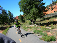
Wonderful Park City Ride on paved parkway trails, around a farm, meadows, woods, over bridges, under a tunnel and circling a park.


  • REGISTRATION: $30 included a t shirt, and lunch.

  • RATINGS: NEWBIES to MODERATE

  • All level of bicycle riders enjoyed this ride.

  • MILEAGE: 3 miles to 12 miles, depending on how far you rode.

  • RESTROOMS: At the church and parks.

  • BBQ LUNCH after the ride. And prizes too!

Wednesday, July 6, 2011

Grand Teton Adventure

Beautiful day for a bicycle ride, taking a ferry over Jenny Lake and hiking to Hidden Falls. What an enjoyable day at the Tetons with Jesus.


GRAND TETON PARKWAY
Park at the Moose Visitor Center. Begin the ride by crossing the street and riding toward Jenny Lake. Make sure you bring a bike lock.


  • RATINGS: Moderate ride on paved parkway trail

  • MILEAGE: 7.5 miles each way

  • RIDE TIME: 45 minutes each way.

  • RESTROOMS: At Visitor Center, parking trailheads and Jenny Lake.

  • FEE: $12 per biker or a National Park Pass

  • GEAR: Bicycle gear, sunscreen, helmet, pump, water, snacks, etc.
JENNY LAKE FERRY
Enjoy a scenic round trip boat ride across the Lake. They even sell Jenny Lake water bottles, full of water. Roundtrip fee for adults is $10. Also, at the boat dock you can rent canoes and kayaks.


HIDDEN FALLS HIKE
Scenic hike up to a roaring falls.


  • MILEAGE: 1/2 mile to falls from boat dock.

  • RATINGS: NEWBIES

  • NO RESTROOMS on this side of the lake.

  • GEAR: Sack lunch, camera, bug spray, water, etc.

Saturday, June 25, 2011

25th ANNIVERSARY


Giving God all the praise and all the glory for the 25th Anniversary and all the friends, exciting adventures, and scenic wonders in Utah! God blessed us with two thrilling hikes!


SUNDANCE 
MANDAN SHORT LOOP
Stewart Falls trail from Sundance is closed due snow at the base of the falls, and the dangerous conditions. The forested trail, has many scenic overlooks. Returning to the chair lift, we enjoyed gliding down the mountain.
RATINGS: Newbies 
MILEAGE: 1 mile
LIFT FEE: Check SUNDANCE for current prices
KID FRIENDLY
HIKE TIME: 40 minutes
RESTROOMS available
NO DOGS allowed on the chairlift
PARKING is limited at Sundance, so please carpool.


ASPEN GROVE to STEWART FALLS
What a great day to be outdoors with Jesus! We saw lots of children hiking on the trail today. It was fun climbing over fallen logs and walking on snow. The falls was exploding with all the Spring runoff.


      RATINGS: Moderate
      MILEAGE: 1.75 miles each way
      HIKE TIME: 2 1/2 hours
      KID FRIENDLY ~ Steep exposure by the falls
      DOGS are allowed on this trail
      FEE: Alpine Loop Fee: (3 day pass $6) or use your National Federal Rec Pass with a mirror hanger.


GOOGLE: SUNDANCE RESORT in UTAH

Saturday, June 18, 2011

Mystery Tour ~ Mountain Biking

Excellent weather! God gave us a cool, sunny day to enjoy. Wonderful wildflowers mixed with the scrub oaks. Today was a big relay race in Park City.


  • DESCRIPTION: We started at the Rail Trail parking in park city, parking lot G. We rode to Quinns trailhead, and up the back side of the Round Valley area. We climbed to the top of the hill and rode down to the ball park and returned to our vehicles.

  • RATINGS: Moderate technical

  • MILEAGE: 11 miles

  • RESTROOMS: Available at the ball park.

  • GEAR: Water, energy snacks, helmet, pump, extra tube, and flat repair tools. BIKE TIME: 2 1/2 hours (stop & go)

  • DIRECTIONS: From SLC take I-80 up Parley's Canyon, exit and turn right at Kimball Junction driving toward Park City, hang a left on Kearns Blvd, then turn right on Bonanza Blvd, make an immediate left on Prospector Ave, drive past the strip mall and park in lot G, by the Rail Trail sign.

PARKCITY.ORG: Trails and maps!

Sunday, June 12, 2011

Jordan River Parkway

Jesus blessed us with a great Sunday afternoon ride. Spring run-off has closed the trail at 7800 South & 4500 South. New wetlands are being created, by flooding fields. Pelicans, ducks and birds love it!


WINCHESTER PARK: 4500 South/7800 South Loop


  • DESCRIPTION: The parkway is a paved trail, beside the Jordan River. There are bridges, boardwalks, underpasses, parks, and sections with multiple trails. There's even benches to sit on.

  • TRAILHEAD: Winchester Park, Winchester St. (6670 S.) and Murray Bluffs Road (1200 West), Murray Utah.

  • RESTROOMS available at the parks.

  • RATINGS: NEWBIES

  • MILEAGE: 11.3 miles total

  • RIDE TIME: 1 1/2 hours

  • GEAR: Helmet, water, pump, bike tools, camera, and snacks.